Despite the humorous name, Cuddle really exists. It’s not a place as such, it’s the name of one of the hills that sit atop the the cliffs that form what is known as
“The Jurassic Coast” World Heritage Site in southern England. You can see it named on this old Ordnance survey map under the “I M” of KIMMERIDGE. You can also see the tramway that runs from Manfield Shaft down to a pier on the shore. These are the salient features that would have spurred Andy on his quest. My own research has discovered that the pier the tramway ran to was destroyed twice in big storms. One was built of iron, the other stone. It is a third, different stone pier that is marked on this map.
 |
| This late 1880’s map of the area, shows Cuddle and the tramway |
Geology is a complex thing, but basically, the underlying rocks of the area, known as “Kimmeridge clay” contains bands of bituminous shale, or shale oil. The strata comes up to the surface of the earth here in the Southwest of England, before diving down and reappearing in North East Lincolnshire, where the foundations of the Humber Bridge were sunk into it. The rock strata then dives down again to emerge a third time as the North Sea oil fields.
As we know, these rocks contain oil, and the shale from here was used as far back as the 1600’s providing fire for glassmaking, and even further back in Roman times when they used the shale to boil seawater in the production of salt. Iron Age amulets have even been found made of the material.
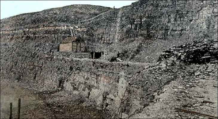
Serious working of the shale appears to have begun in the mid 1800’s. The shale oil was used to make products like varnish, pitch, naphtha, and dyes. The first tramway was built in 1848 and this is when the first adits were bored into the cliff faces. In some places works buildings appeared on the wave cut platforms on the cliff face. The most noted being that at a place called Clavell’s Hard.
 |
| The adit and works at Clavell’s Hard in the 1890’s |
That location certainly gives you ideas for a very spectacular model railway doesn’t it?
Many companies tried to mine the shale as a profitable business, but all of them failed.
The Mansfield mine shaft was sunk in 1883 and the tramway extended. Though I can find no information to suggest it was anything other than a horse worked line. The mine reached its maximum extent of 5,000 feet of tunnel in 1890 and things must have looked good. But before the end of the decade oil shale mining had ceased.
A survey in 1918 determined that the thinness of the seams and the high sulphur content of the shale meant that mining was always unprofitable and the owners were really on a hiding to nothing.
The oil is there though, and should be able to be reached if the market conditions make it profitable. In fact, there has been a “nodding donkey” pump in the area tapped into the oil reservoirs since 1959.
It’s unlikely that shale oil mining will ever return to the area, but it has already had a fascinating history.